Roman Montacute
[Image is part of the Lopen mosaic, unearthed in 2001. Wikipedia October 2021.]
Montacute parish encompasses the eastern side of Ham Hill, and this is where we see most evidence of Roman occupation in the parish. This webpage explores Roman occupation and roads in the area, including the Fosse Way, coin hoards, and other archaeological finds from Ham Hill, alongside photos of Roman items on display at the Museum of Somerset. Click the links (blue text) for more in-depth information about each topic.
Montacute is surrounded by sites that were occupied in Roman times. A couple of years after the Roman conquest of Britain in 43 AD, Ham Hill was captured by the future emperor Vespasian and the Roman Second Legion, who had already captured Maiden Castle and other hill forts to the south and east. Evidence of Roman occupation includes a military camp towards the north end of Ham Hill, Roman burials, and a Roman villa at The Warren, the field at the Montacute end of the Ham Hill hillfort.
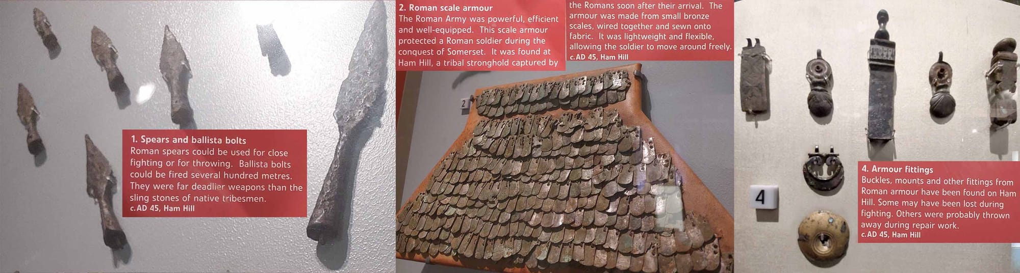
Photos below of Roman items from Ham Hill on display at the Museum of Somerset in Taunton, photographed 2023:
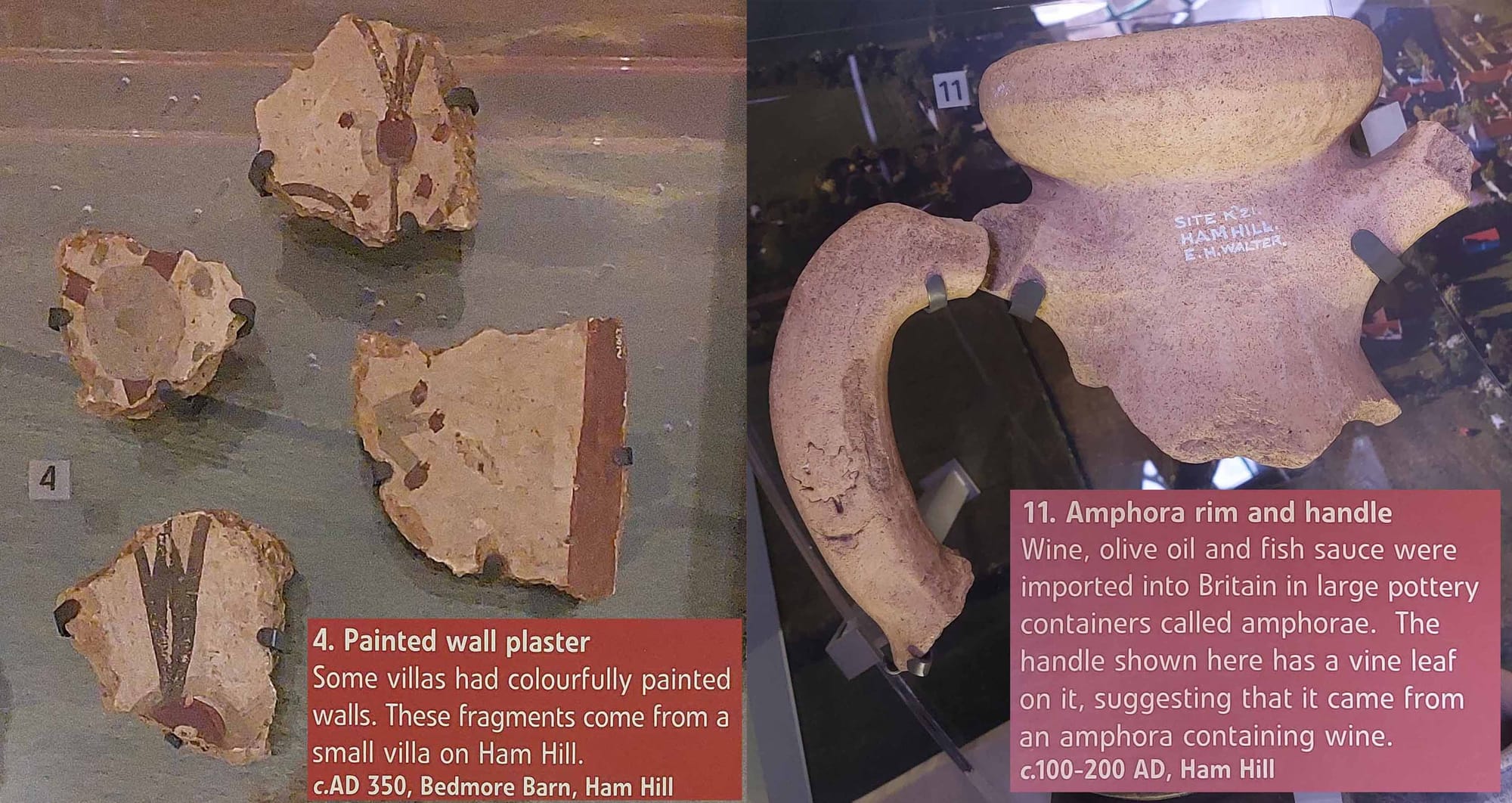
The earlier Roman coins from Ham Hill date from AD 81 and Roman coins from the villa date from the periods of Severus Alexander (222-235) to Gratian (367-383). A 1936 article by Myres and Sutherland in The Numismatic Chronicle (https://www.jstor.org/stable/42660952) describes a Roman vase of coins in the Library of Christ Church, Oxford, probably discovered "on the eastern side of Ham Hill" prior to 1814. The 491 coins were buried in about 270 AD. They may have been part of the hoard of 3 vessels of Roman coins that were found in 1882 near 'Bedmore Barn' (now known as Batemore or Batemoor Barn), just within the east side of the earthworks where the lane meets the plateau (close to the aforementioned Roman villa at The Warren) (Seaby 1949; https://www.jstor.org/stable/42661417). One vessel, containing 338 sestertii, was given to Taunton museum in 1915 by Mr Phelips. Samples of the coins from the other 2 vessels were also subsequently donated; estimates suggest the 3 vessels together may have contained 2000 coins, although Seaby suggests 1000 coins is more likely. The Somerset Historic Environment records on the Roman occupation of Ham Hill give much more detail.
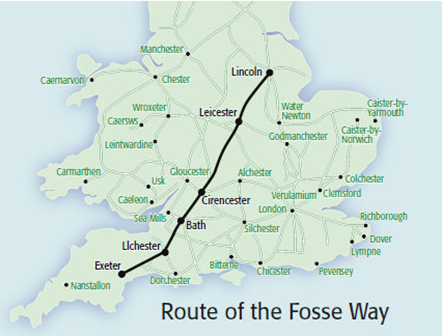
In the 1st and 2nd century AD the Fosse Way military road was built from Lincoln to Exeter, along a defensive ditch (fossa) which marked the western border of Roman-controlled Britain (map from British Heritage website), passing about a mile north of Ham Hill. Ilchester (Lendiniae or Lindinis) may have started as a Roman Control point for the crossing over the R. Yeo at Ilchester (there is an interesting discussion on the website https://www.cartographyunchained.com/rm2/, accessed 22.11.21), and it became a significant Roman town. An Iron Age/Celtic (2nd to 1st century BC) oppidum lies just south of the Roman and modern-day town centre. Miranda Richardson's 2002 publication for the Somerset EUS (Extensive Urban Survey), An Archeological Assessment of Ilchester, describes the evolution of the town and the archeological evidence for it.
The Fosse Way is marked by the route of the A303 from Ilchester to Petherton Bridge, and then follows country lanes to Over Stratton and Dinnington, where in 2002 Channel 4’s Time Team uncovered a mosaic in nearby fields (Somerset Historic Environment Record 53887). Another Roman villa, at Lopen is about 2 miles from the Dinnington villa site, on the other side of the Fosse Way.
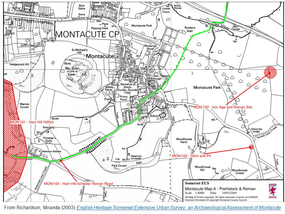
A less significant Roman road (which probably pre-dates its use in Roman times) goes south from Ilchester along Sock Lane and Kissmedown Lane, past Windmill Farm and the remains of Odcombe Mill, across Montacute Park to Back Lane and then through Townsend to Ham Hill. This is described in Richardson's 2003 archaeological assessment of Montacute (image below). The field to the north of this road on Ham Hill was the site of the Roman Villa at The Warren mentioned above. Other possible villa sites have been found in the area on private land at Sock Dennis Farm near Ilchester, at Lufton (Historic England Entry 1006159 and also Somerset HER 53634), and at Stanchester. (Despite what is said on some sites, the Stanchester Hoard of Roman coins did not come from there, but from a site near Marlborough in Wiltshire!) The portion of the Roman road where it crosses the park, from the site of the old 'Odcombe Mill' through to where it emerges into Back Lane, is no longer visible on the ground. (Confusingly Odcombe Mill is the name of the Mill whose remains can still be found on the north edge of Montacute Park, while Montacute Mill used to be in the grounds to the west of Montacute House.)
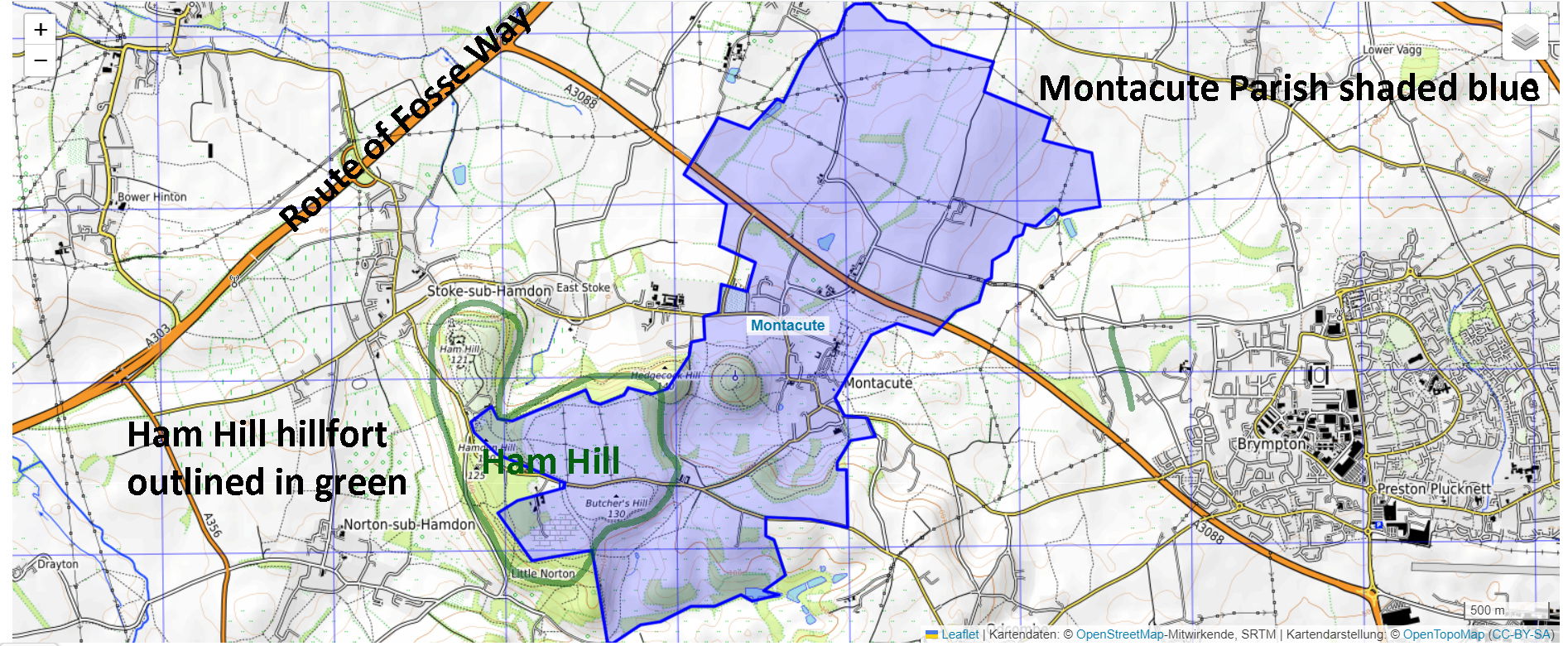
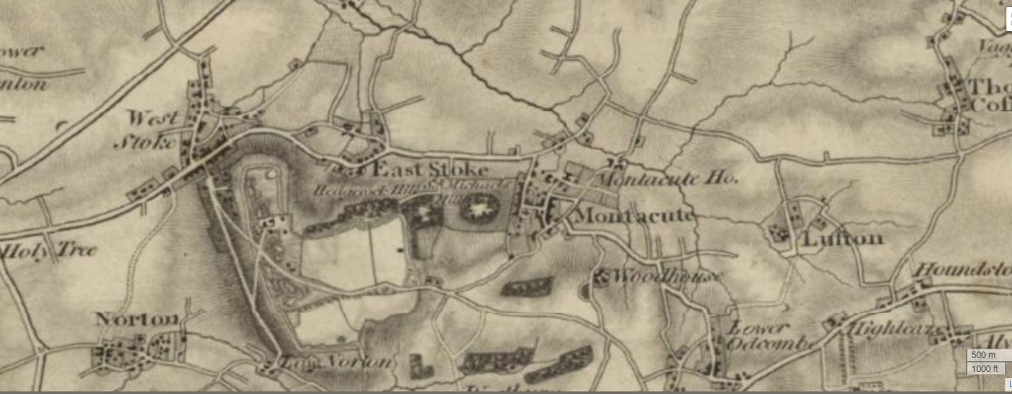
The ARCHI UK archaeological sites website includes a Victorian Ordnance Survey 1 inch to 1 mile map dating from 1805-1869 which shows the Ham Hill-Ilchester Roman Road (marked green on the map above), and on this it can be seen that the part of the road that crosses Montacute Park to the east of Montacute House (from the Mill to Back lane) was still in existence in the 19th century:
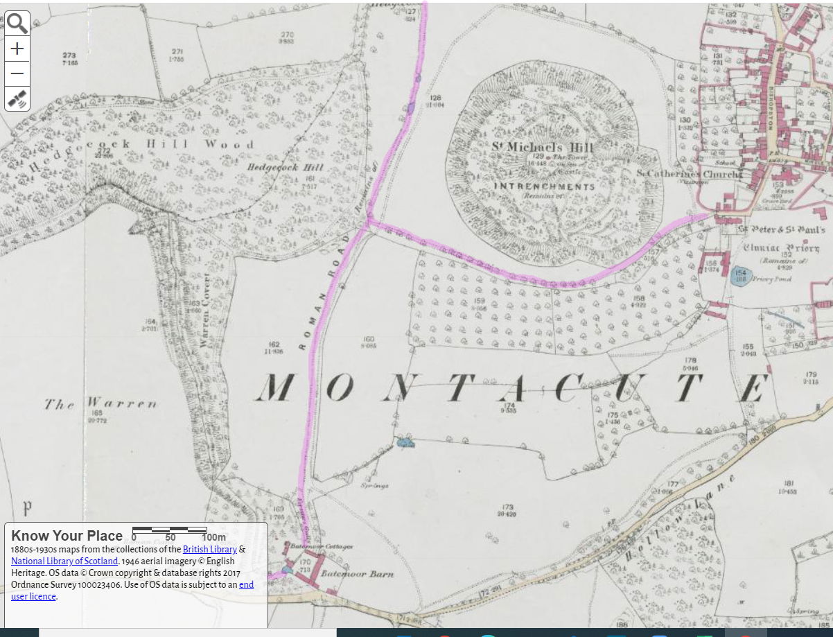
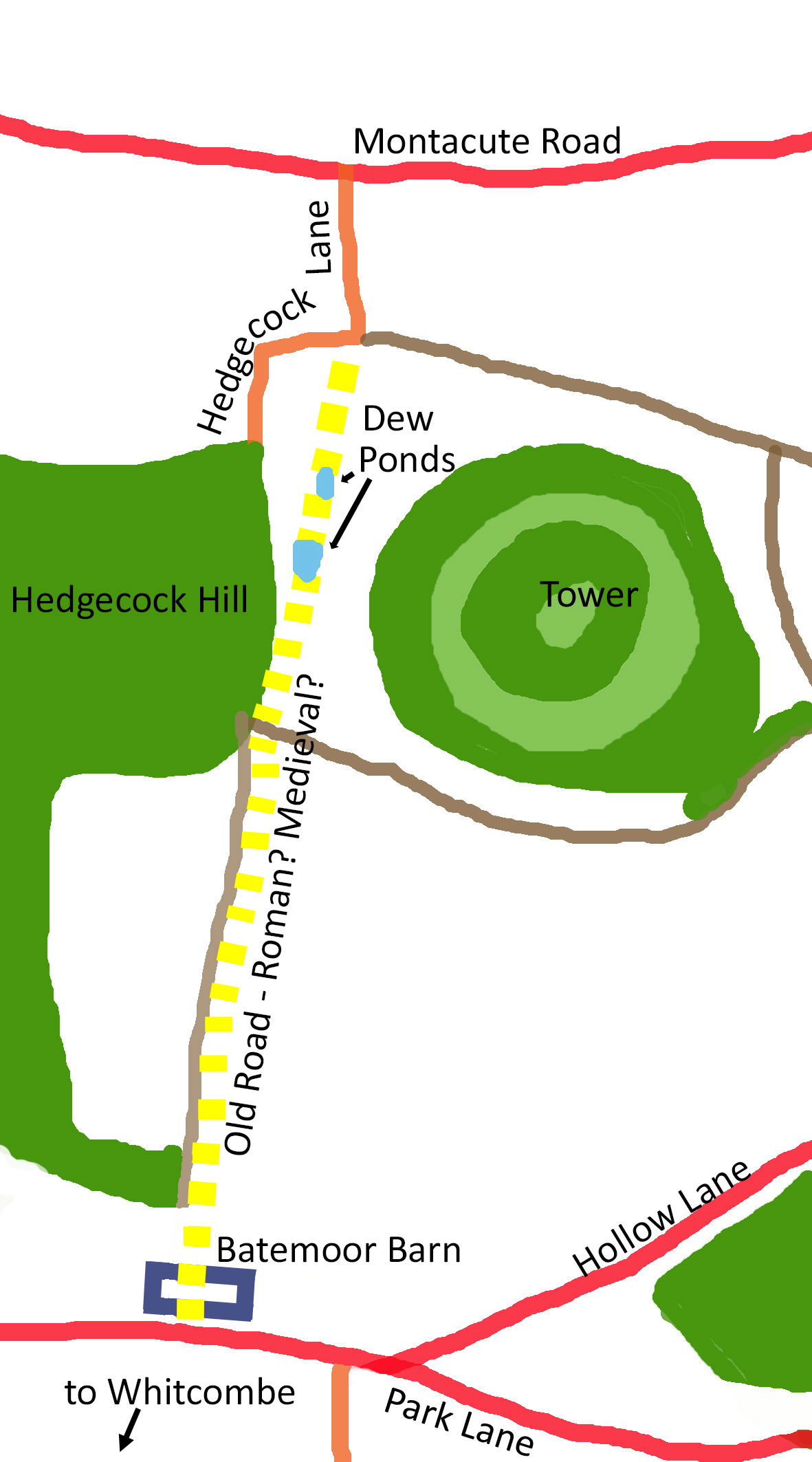
Another Roman road close to Montacute is shown on Ordnance survey maps as travelling south from Montacute Road, skirting the east edge of Hedgecock Hill (highlighted pink on the map below). This road goes past Under Warren where there may be a deserted medieval settlement, and meets the Ilchester-Ham Hill Road near Batemore Barn. The Somerset Historic Environmental Record of the site (ref. 55114) suggests this was actually a medieval lane to the now-deserted (plague?) village of Witcombe. There is a track known locally as 'coach road' which leads west from the village passing the north side of the Abbey gatehouse; I have also highlighted this in pink on this screenshot (below) from excellent Know Your Place (KYP) west website (click 'basemaps' to bring up the different options). The route skirts the south side of St Michael's Hill, meeting the Roman Road marked on the map (Somerset Historic Environment Record 31114). I don't know if this later 'coach road' would have turned south along Under Warren (below Warren Covert) and up through Forster's Gulley (shown as Forester's Gulley on the map below) to Batemoor Barn, or north through the sunken road (where the dew ponds are/were) into Hedgecock Lane and then along the modern route to Stoke-sub-Hamdon and up to Ham Hill, or maybe it would have gone directly along the bottom (north) or across the top (south) of Hedgecock Hill. It is not shown on the 1805-1865 map above.
On the 1805-1865 map it looks like a road ran from the west of Batemoor Barn, northwards along the edge of the field called 'The Warren', crossing Hedgecock Hill and then veering right to join Hedgecock Lane. If this road was continued north instead of turning east into Hedgecock Lane it would join the drive of East Stoke House; according to this 19th century map it seems Windsor lane also exited onto Montacute Road at the same place as the drive to East Stoke House. This aligns directly with Welham's Mill, and may indicate an old route from Ham Hill to Welham's Mill.